

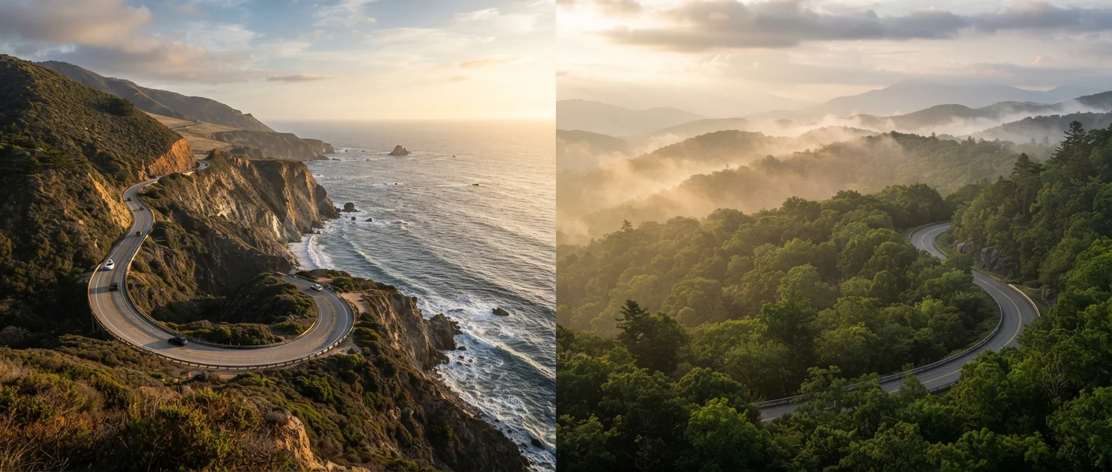
Option A
Pacific Coast Highway (PCH)
The iconic coastal drive with endless ocean views and California energy.
Best for: Travelers who want dramatic seaside scenery, urban cultural stops, and a sunny West Coast vibe.
Option B
Blue Ridge Parkway
The serene Appalachian highlands route rich in forest, folklore, and fall color.
Best for: Travelers seeking immersive nature, Appalachian heritage, and unhurried scenic solitude.
The Routes at a Glance
The Pacific Coast Highway - officially California State Route 1 - runs along the California coastline, with the most celebrated stretch connecting Los Angeles and San Francisco through Big Sur. Drivers can extend the journey northward toward the Oregon border or south toward San Diego. The route is defined by its raw edge: cliffs dropping into the Pacific, sea stacks rising from the surf, and coastal towns like Carmel-by-the-Sea and Morro Bay dotting the way.
The Blue Ridge Parkway, administered by the National Park Service, links Shenandoah National Park in Virginia to Great Smoky Mountains National Park in North Carolina. At 469 miles, it's shorter than a full PCH run, but the road is deliberately slow - a 45 mph speed limit encourages frequent stops at overlooks, meadows, and trailheads. The Parkway was designed purely for recreational driving; no commercial traffic is permitted.
| Criterion | Pacific Coast Highway | Blue Ridge Parkway |
|---|---|---|
| Total distance (core route) | ~655 miles (LA to SF and beyond) | 469 miles (VA to NC) |
| Primary scenery | Ocean cliffs, beaches, coastal towns | Mountain forests, meadows, overlooks |
| Major city access | LA, San Francisco, Santa Barbara | Asheville; smaller gateway towns |
| Best season | Summer and early fall | Fall (foliage) and summer |
| Road tolls | None on Route 1 itself | No tolls |
| Speed limit | Varies; watch for 25-55 mph zones | 45 mph maximum throughout |
| Seasonal closure risk | Landslides, winter storms | Ice, snow at elevation |
| Wildlife viewing | Marine mammals, shorebirds, elk | Black bears, deer, wild turkeys |
For travelers who want to understand what differentiates route planning for a road trip versus other travel modes, our road trip planning guide covers the key preparation differences in detail.
Scenery, Stops, and Highlights
On the PCH, the scenery is relentlessly cinematic. Big Sur is the headline act - roughly 90 miles of coastline with almost no commercial development, punctuated by the iconic Bixby Creek Bridge. Hearst Castle near San Simeon adds a cultural detour, while Point Reyes National Seashore north of San Francisco rewards wildlife watchers with elk herds and lighthouse views. Cities along the route mean you're never far from excellent food, museums, and accommodation variety.
The Blue Ridge Parkway trades coastal drama for layered mountain grandeur. Highlights include Mabry Mill in Virginia - one of the most-photographed spots on the entire route - along with Grandfather Mountain, the Linn Cove Viaduct (an engineering marvel hugging the mountainside), and the craft-brewery and arts hub of Asheville, North Carolina. Appalachian folk music traditions and regional cuisine give this drive a distinct cultural character that the coast doesn't replicate.
469 miles
Blue Ridge Parkway total length
The National Park Service notes the Parkway is one of the most-visited units in the entire national park system, consistently welcoming tens of millions of visitors annually.
~90 miles
Length of Big Sur coastline on PCH
Big Sur's stretch of California Route 1 is widely cited as one of the most scenically dramatic coastal roads in the world, with almost no commercial development along its corridor.
45 mph
Maximum speed on Blue Ridge Parkway
The enforced 45 mph limit is intentional - the road was designed by the National Park Service specifically for leisurely recreational driving, not efficient transit.
If comparing coastal road trips appeals to you, our Gulf Coast vs. Atlantic Coast comparison explores what each shoreline region actually offers.
Logistics: Season, Crowds, and Planning
PCH timing matters considerably. Summer is peak season and coastal towns can fill quickly, particularly around Big Sur. Winter brings the risk of fog, rain, and - after heavy storms - occasional landslides that may close sections of the highway for extended periods. Always check Caltrans road conditions before departing. California fuel costs tend to run higher than the national average, which affects overall trip budgeting.
The Blue Ridge Parkway is most visited during fall foliage season (roughly mid-October through early November), when overlooks can become genuinely crowded on weekends. Summer offers lush green solitude and comfortable temperatures at elevation. Winter closures affect portions of the Parkway due to ice and snow - the NPS posts current closure information online and that should be your first stop when planning a cold-weather trip. Both routes reward an early start each day to claim parking at the most popular overlooks.
Verify Conditions Before You Go
Both routes are subject to temporary closures - PCH from coastal storms and landslides, the Blue Ridge Parkway from winter ice at higher elevations. Always check current road conditions through Caltrans (for PCH) and the National Park Service website (for the Parkway) before your departure date. Conditions can change quickly, and some closures last days or weeks rather than hours.
The content on this site is for informational purposes only and is not a substitute for professional advice. Always consult a qualified professional for guidance specific to your situation.