

A Landscape Written in Rock
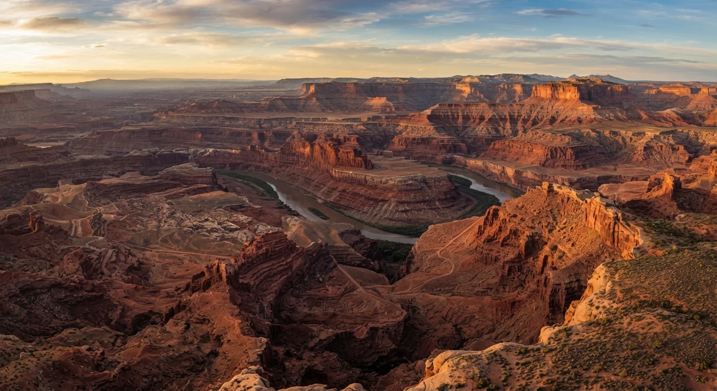
Few places on Earth let you read geological time as clearly as the American Southwest. Stand on the rim of the Grand Canyon and you're looking at nearly 2 billion years of Earth's history stacked beneath your feet - ancient seafloor, desert dunes, and river deltas all preserved in vivid bands of red, tan, and gray. This is the defining character of the region: an almost uninterrupted archive of deep time made visible by erosion.
The foundation of this story is the Colorado Plateau, a broad elevated tableland covering roughly 130,000 square miles across Utah, Arizona, Colorado, and New Mexico. Unlike much of the surrounding American West, the Plateau avoided major folding and faulting during periods of intense tectonic activity. This stability allowed sedimentary layers - deposited across hundreds of millions of years - to remain flat, stacked, and readable. When rivers and streams began cutting downward, they sliced through those layers like a knife through a layer cake, revealing the full sequence below.
“The Grand Canyon is a land of song. Mountains of music swell in the rivers, hills of music billow in the creeks, and meadows of music murmur in the rills that ripple over the rocks.”
— John Wesley Powell, Explorer and geologist who led the first documented expedition through the Grand Canyon (1869)
Forces That Carved the Icons
Erosion is the Southwest's most powerful sculptor. Water, despite the region's reputation for dryness, is the primary agent. Seasonal flash floods carve slot canyons through sandstone with remarkable speed and precision - places like Antelope Canyon in Arizona demonstrate how flowing water laden with sand can polish rock into sinuous, glowing corridors.
At Bryce Canyon National Park, a different process dominates: frost wedging. Water seeps into cracks in the soft Claron limestone, freezes overnight, and expands - widening fissures until columns of rock separate from the surrounding cliffs. Harder caprock protects the tops of these columns, leaving behind the tall, otherworldly spires called hoodoos. Bryce sits at an elevation where freeze-thaw cycles occur roughly 200 days a year, making it one of the most active hoodoo factories on the planet.
Wind erosion plays a quieter but equally important role, rounding the fins and dunes of Arches National Park and the broader canyon country of southern Utah. Over millions of years, collapsed salt domes underground created the cracks that wind and water then widened into arches and windows.
Best Times to See Erosion Features
Visit canyon country in spring or fall when temperatures are moderate and afternoon thunderstorms - which drive flash flooding and active erosion - are less frequent. Summer monsoon season (July-September) brings dramatic storms that can make slot canyons and wash crossings dangerous. Always check weather forecasts and flash flood warnings with the relevant National Park Service office before entering narrow canyon areas.
Volcanoes, Faults, and a Stretching Landscape
The Colorado Plateau is only part of the Southwest's geological story. To its south and west lies the Basin and Range Province - a region where Earth's crust is being slowly pulled apart. This stretching thins the crust, causing blocks of rock to drop down (forming valleys called grabens) while adjacent blocks remain elevated (forming horsts, or ranges). The result is the dramatic alternating pattern of mountain ranges and flat desert basins visible across Nevada, Arizona, and New Mexico - including the iconic silhouettes of the Sonoran Desert.
Volcanic activity has also left its mark across the region. New Mexico's Valley of Fires preserves a lava flow barely 5,000 years old - geologically speaking, yesterday. Arizona's San Francisco Volcanic Field contains over 600 cinder cones, with Sunset Crater forming just around 1,000 years ago. These features remind visitors that the Southwest's geology is still very much in progress.
~2 billion
Years of rock history exposed in the Grand Canyon
The oldest exposed rocks at the Grand Canyon's inner gorge, the Vishnu Basement Rocks, are estimated to be approximately 1.8 billion years old, according to the National Park Service.
130,000 sq mi
Area of the Colorado Plateau
The Colorado Plateau spans parts of Utah, Arizona, Colorado, and New Mexico and is considered one of the world's best-preserved sedimentary rock archives.
~200 days/year
Freeze-thaw cycles at Bryce Canyon
Bryce Canyon's high elevation produces approximately 200 freeze-thaw days annually, making it one of the most geologically active hoodoo-forming environments on Earth.
Before exploring these remote landscapes, it's worth being well-prepared. Many geological wonders sit far from services and emergency assistance - see our guide on safely driving desert highways before you set out.
Why Aridity Preserves It All
One underappreciated reason the Southwest's geology is so readable is the climate itself. Arid and semi-arid conditions mean sparse vegetation, which means rock faces aren't hidden beneath soil and plant cover. Chemical weathering - which breaks down minerals through moisture and biological activity - proceeds far more slowly in dry air. Rock formations that would be buried or decomposed in a wetter climate stand exposed and sharp for millions of years in the desert.
This dryness also concentrates erosive power into rare but intense events: desert cloudbursts and flash floods move enormous volumes of sediment in hours. The combination of long preservation and dramatic, periodic erosion gives the Southwest its signature look - pristine, layered, and seemingly frozen in time, yet actively changing beneath the surface.
For travelers, this means every visit to a national park or geological monument in the region is genuinely irreplaceable. The landscapes of the Grand Canyon, Monument Valley, Capitol Reef, and the Chihuahuan Desert are windows into Earth's deep past that exist in their current form precisely because of this rare balance of forces - and nowhere else on Earth does that balance play out quite the same way.
Respecting Tribal Lands and Protected Sites
Many of the Southwest's most spectacular geological features sit on or adjacent to Native American tribal lands and federally protected monuments. Antelope Canyon, for example, is on Navajo Nation land and requires a guided tour with a Navajo-authorized operator. Always verify access requirements, permits, and cultural protocols with the managing authority before visiting. Leave-No-Trace principles apply throughout the region.
Frequently Asked Questions
The Grand Canyon's walls reveal layer upon layer of sedimentary rock deposited over nearly 2 billion years in ancient seas, rivers, and deserts. The Colorado Plateau's relative tectonic stability kept these layers largely flat and intact. The Colorado River then carved through them over millions of years, exposing the full sequence.
Hoodoos form through a process called frost wedging combined with differential erosion. Water seeps into cracks in the soft limestone, freezes and expands, widening the fractures. Harder rock caps protect the columns beneath while softer material erodes away, leaving the tall, spire-like formations Bryce Canyon is famous for.
Yes - the region remains geologically dynamic. The Basin and Range Province continues to stretch and pull apart, causing occasional earthquakes. Volcanic fields in New Mexico and Arizona are considered geologically young. The San Andreas Fault system also affects the western edge of the region.
The Colorado Plateau is a large elevated region covering parts of Utah, Arizona, Colorado, and New Mexico. It remained tectonically stable while surrounding land buckled and faulted, preserving a thick stack of sedimentary rock layers. This stability makes it home to some of the world's most remarkable canyon and mesa landscapes.
The content on this site is for informational purposes only and is not a substitute for professional advice. Always consult a qualified professional for guidance specific to your situation.